PennDOT
Chartiers Street (SR2034) Final Design
A Photo-Realistic Rendering Executed Efficiently and Economically.
The Challenge:
Provide requested rendering on a limited budget.
Our Solution:
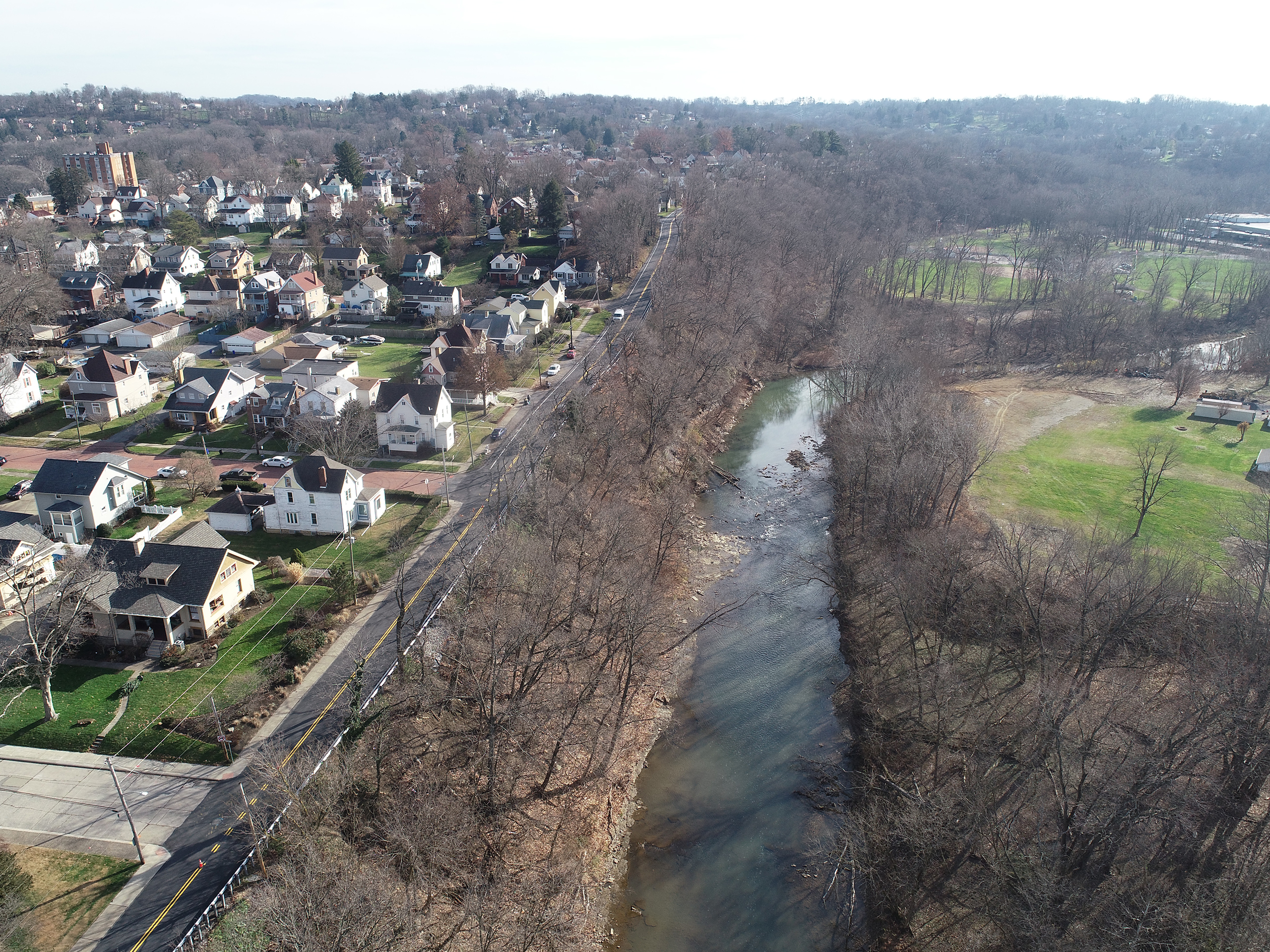
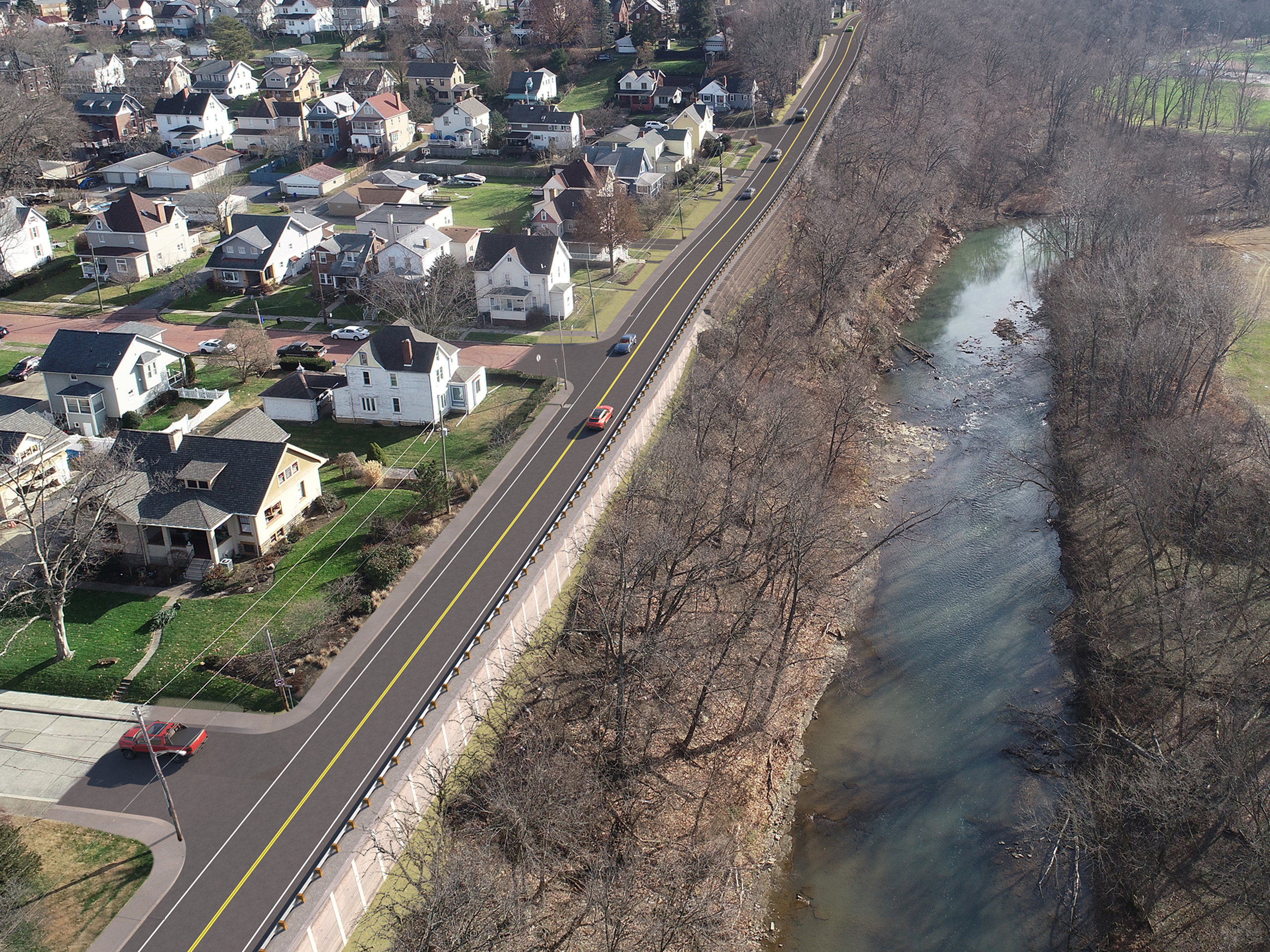
Before
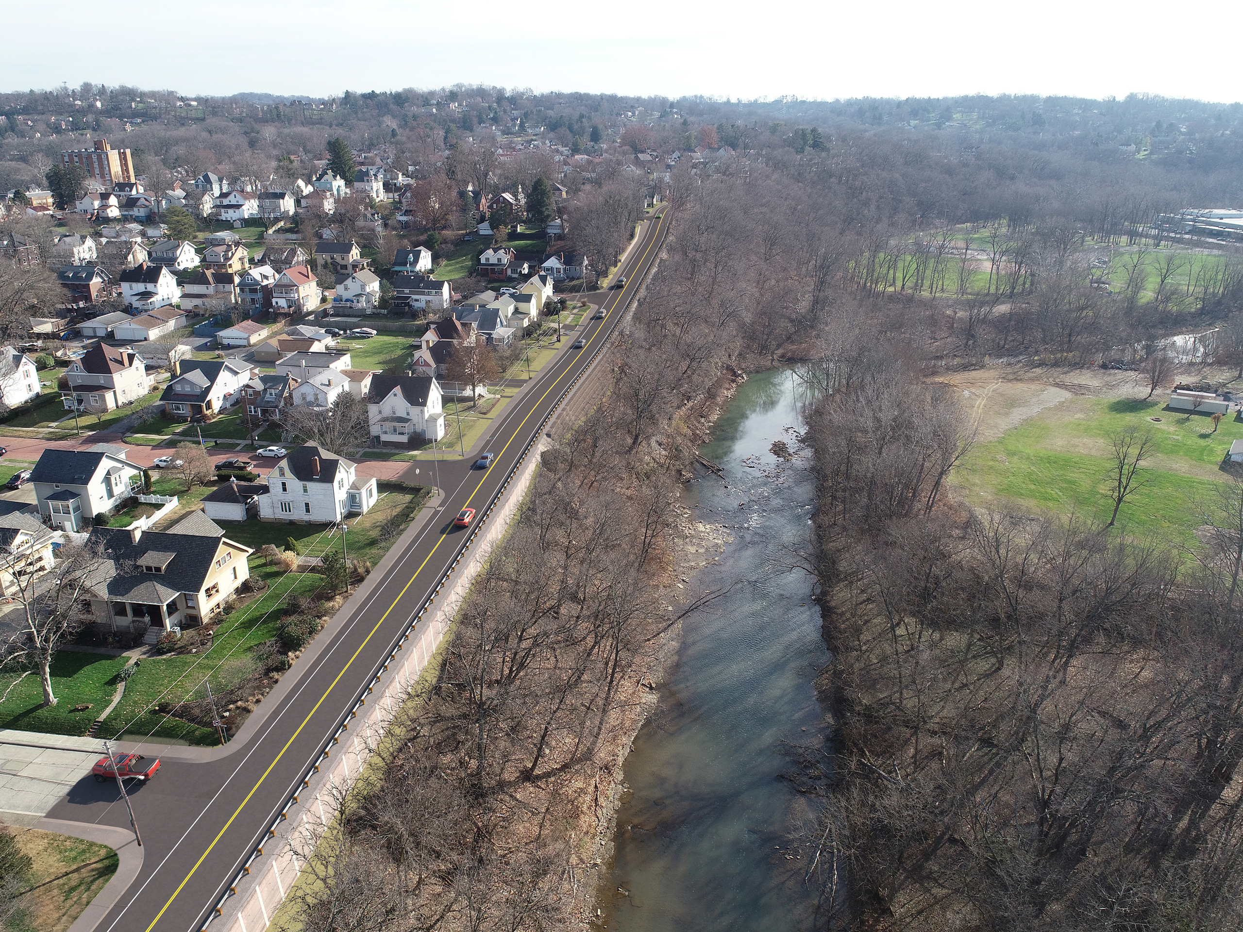
After
How We Helped:
Using UAS aerial photos provided by the client, the team then produced a final photo-realistic aerial rendering. Both the preliminary and final rendering were delivered 5 hours under the estimated/proposed 26-hour budget.
Services:
- Autodesk 3DS Max & AutoCAD
- Chaos Group VRay
- Bentley MicroStation & OpenRoads
- Itoosoft Forest Pack Pro & RailClone
- Adobe Photoshop